Weather update
Published 8:48 am Wednesday, September 15, 2021
|
Getting your Trinity Audio player ready...
|
Christina Leach, NWS Mobile/Pensacola, provided the following information regarding weather for this week.
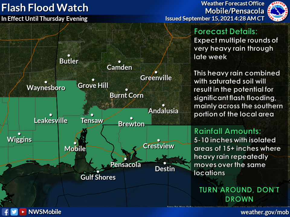
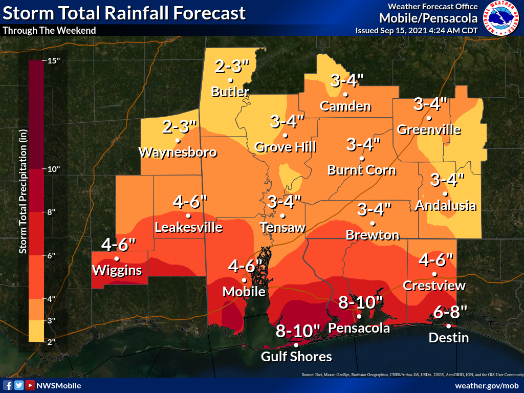
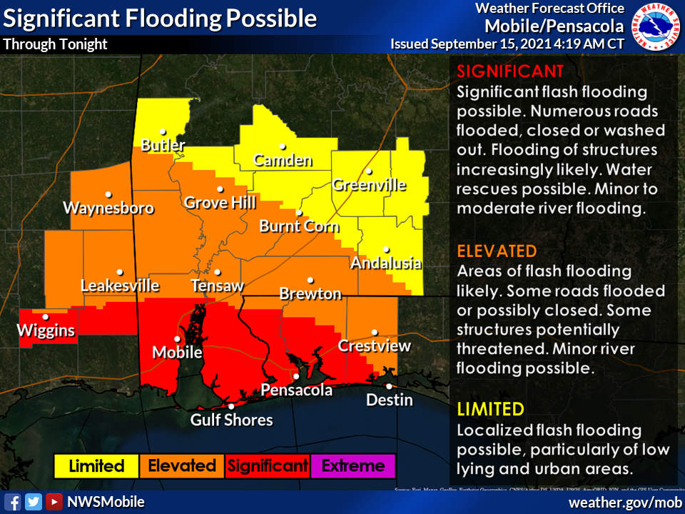
Overview: A significant heavy rainfall and flooding event is evolving that will likely persist through late week and into the weekend. Some adjustments were made to rainfall totals, but the Flash Flood Watch areas have not changed.
- WHAT: Excessive rainfall of 5 to 10″ with locally higher amounts in excess of 15″ (especially closer to the coast). This will likely result in significant flooding along with river flooding (especially the smaller rivers along the coast).
- WHEN: Through late Thursday, with a possible second round of heavy rainfall between Friday and Sunday that could produce rainfall in excess of what is discussed above.
- WHERE: Generally south of the Highway 84 Corridor and closer to the coast, to include portions of interior southeastern MS, coastal AL, portions of interior southwestern AL and the western FL Panhandle.
- CONFIDENCE: Confidence continues to increase for the occurrence of an excessive multi-day rainfall event that will likely result in significant flooding.
Please see the attached graphics for additional information. If you have any questions or concerns, don’t hesitate to contact us on the forecast desk.