Monday afternoon could include severe storms
Published 9:33 am Monday, March 25, 2019
|
Getting your Trinity Audio player ready...
|
UPDATE: Just before 5 p.m., the National Weather Service issued a severe thunderstorm watch for Butler County.
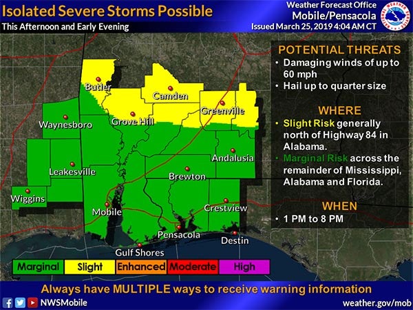
As a cold front approaches Greenville this afternoon, the area could see some severe storms, according to the Butler County Emergency Management Agency (EMA).
According to EMA Director Kris Ware, the front will bring showers and thunderstorms to the area this afternoon and tonight. A slight risk of severe storms is indicated for an area located north of U.S. 84.
“The front is crossing into Alabama now,” Ware said Monday morning just after 9 a.m. “We could see some high winds and hail this afternoon and tonight; that is the main threat. It appears the potential for tornadoes is unlikely, but we could see wind gusts up to 60 mph and hail up to the size of a quarter.”
Ware urges everyone to be aware of the weather and stay tuned to local media and weather radios for updates.
The Greenville Advocate will post updates as weather changes occur.


