Tropical Storm Warning issued for Butler County
Published 5:09 pm Tuesday, October 9, 2018
|
Getting your Trinity Audio player ready...
|
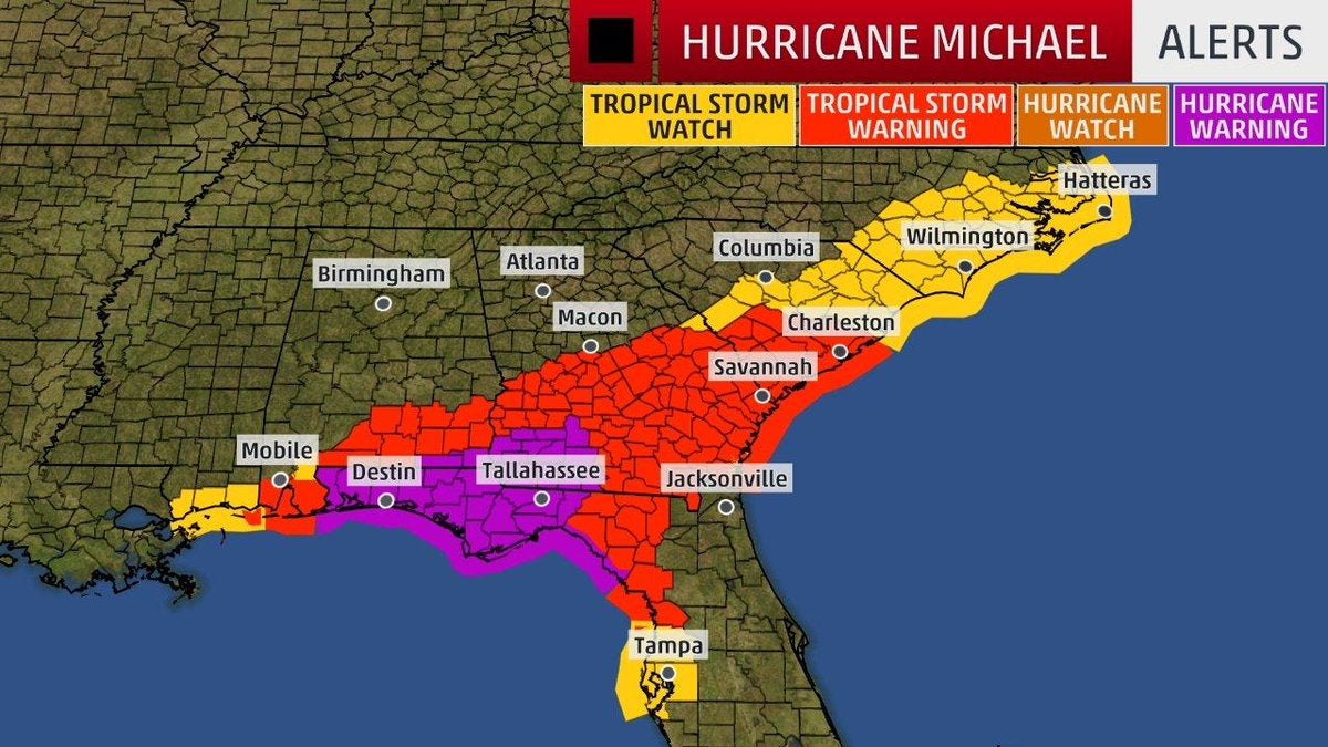
According to the National Weather Service, Butler County has been placed under a Tropical Storm Warning ahead of Hurricane Michael, which continues to strengthen in the Gulf Coast and is expected to make landfall Wednesday.
A Tropical Storm Warning means tropical storm-force winds are expected somewhere within this area within the next 36 hours.
Below is the warning from the NWS:
LOCATIONS AFFECTED – Greenville
WIND – LATEST LOCAL FORECAST: Tropical storm force winds remain possible – Peak Wind Forecast: 15-25 mph with gusts to 35 mph – POTENTIAL THREAT TO LIFE AND PROPERTY: Potential for wind 58 to 73 mph – The wind threat has remained nearly steady from the previous assessment.
PLAN: Plan for dangerous wind of equivalent strong tropical storm force due to possible forecast changes in track, size, or intensity.
PREPARE: Remaining efforts to protect life and property should be completed as soon as possible. Prepare for significant wind damage.
ACT: Move to safe shelter before the wind becomes hazardous.
POTENTIAL IMPACTS: Significant
- Some damage to roofing and siding materials, along with damage to porches, awnings, carports, and sheds. A few buildings experiencing window, door, and garage door failures. Mobile homes damaged, especially if unanchored. Unsecured lightweight objects become dangerous projectiles.
- Several large trees snapped or uprooted, but with greater numbers in places where trees are shallow rooted. Several fences and roadway signs blown over.
- Some roads impassable from large debris, and more within urban or heavily wooded places.
- Scattered power and communications outages, but more prevalent in areas with above ground lines.
FLOODING RAIN – LATEST LOCAL FORECAST: – Peak Rainfall Amounts: Additional around 1 inch
POTENTIAL THREAT TO LIFE AND PROPERTY: Potential for localized flooding rain – The flooding rain threat has remained nearly steady from the previous assessment.
PLAN: Emergency plans should include the potential for localized flooding from heavy rain.
PREPARE: Consider protective actions if you are in an area vulnerable to flooding.
ACT: Heed any flood watches and warnings.
POTENTIAL IMPACTS: Limited – Localized rainfall flooding may prompt a few evacuations. – Rivers and tributaries may quickly rise with swifter currents. Small streams, creeks, canals, and ditches may become swollen and overflow in spots. – Flood waters can enter a few structures, especially in usually vulnerable spots. A few places where rapid ponding of water occurs at underpasses, low-lying spots, and poor drainage areas. Several storm drains and retention ponds become near-full and begin to overflow. Some brief road and bridge closures.
TORNADO – LATEST LOCAL FORECAST: – Situation is unfavorable for tornadoes
POTENTIAL THREAT TO LIFE AND PROPERTY: Tornadoes not expected – The tornado threat has remained nearly steady from the previous assessment.
PLAN: Tornadoes are not expected. Showers and thunderstorms with gusty winds may still occur.
PREPARE: Little to no preparations needed to protect against tornadoes at this time. Keep informed of the latest tornado situation.
ACT: Listen for changes in the forecast.
POTENTIAL IMPACTS: Little to None – Little to no potential impacts from tornadoes.
FOR MORE INFORMATION: – For local information, please refer to: Butler County EMA: (334) 382-7911.


