Storm could be severe
Published 12:49 pm Sunday, November 23, 2014
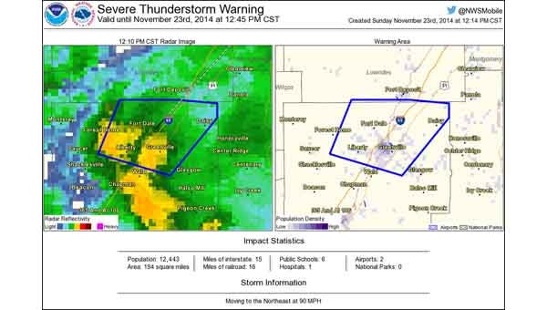
Latest from the NWS in Mobile: The worst of the storm is in the Greenville area.
The Crenshaw EMA said this is a very fast-moving system, approximately 50 mph, which could intensify the storms associated with it. Damaging winds, isolated tornadoes and heavy rain causing localized flooding are possible. Storms will move rapidly to the east, northeast. Heavy rainfall may result in localized flash flooding in urban areas. It will be windy through much of Sunday, even outside storms and after storms move through. Sustained 20-30 mph winds with gusts to 40 mph are expected.
EMA director Earl Thompson said the storm could get intense for Crenshaw County.
“This system is part of the jet stream and has warm, moist unstable air and the chances of severe weather has increased,” he said. “My recommendation is to start getting things ready in the case of power outages and property damage and just be preparing for the worst and praying for the best.”