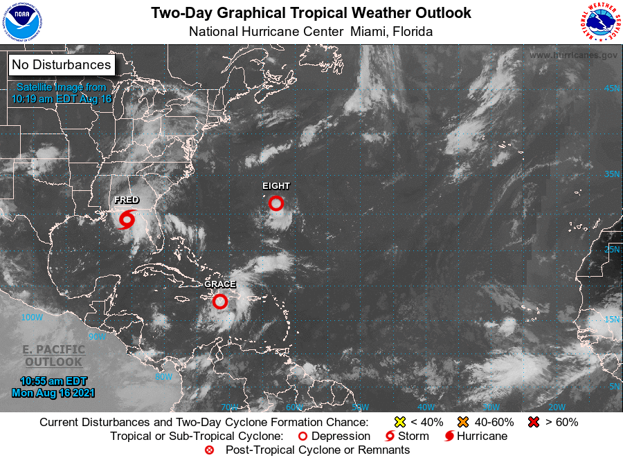
Update on Tropical Storm Fred
Published 10:08 am Monday, August 16, 2021
|
Getting your Trinity Audio player ready...
|

Overview/What’s New: Tropical Storm Fred is forecast to strengthen to a strong tropical storm prior to landfall. The track of the storm has shifted slightly further east and is now forecast to make landfall east of Destin, FL.
Potential Threats:
- Tropical Storm Force Winds between 40-50 mph, especially in gusts, are becoming increasingly likely in Okaloosa Co, FL, and possible further north into Covington Co, AL.
- Heavy Rainfall and Flash Flooding is possible in Okaloosa Co, FL, Covington Co, AL, and Crenshaw Co, AL, where a Flash Flood Watch remains in effect. Rainfall totals of 2 to 4 inches will be possible with locally higher amounts possible along the coast near Destin.
- Minor Coastal Flooding of 1-3 feet is expected across coastal locations within the western Florida Panhandle.
- High Surf and Wave Run-up may result in additional flooding along coastal Alabama and the western Florida Panhandle.
- An isolated tornado cannot be ruled out over portions of the western Florida Panhandle and south-central Alabama this morning through early afternoon.
Confidence: Increasing regarding a landfall of a strengthening tropical storm along the western Florida Panhandle, most likely east of Destin.
 Fred Briefing Packet_081621_5am