Latest update on weather {Gallery}
Published 2:47 pm Monday, February 15, 2021
|
Getting your Trinity Audio player ready...
|
Latest update from the National Weather Service in Mobile:
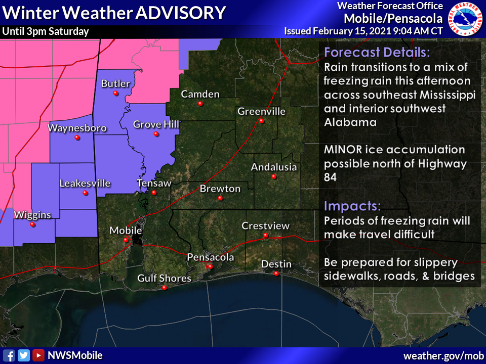
Winter Weather
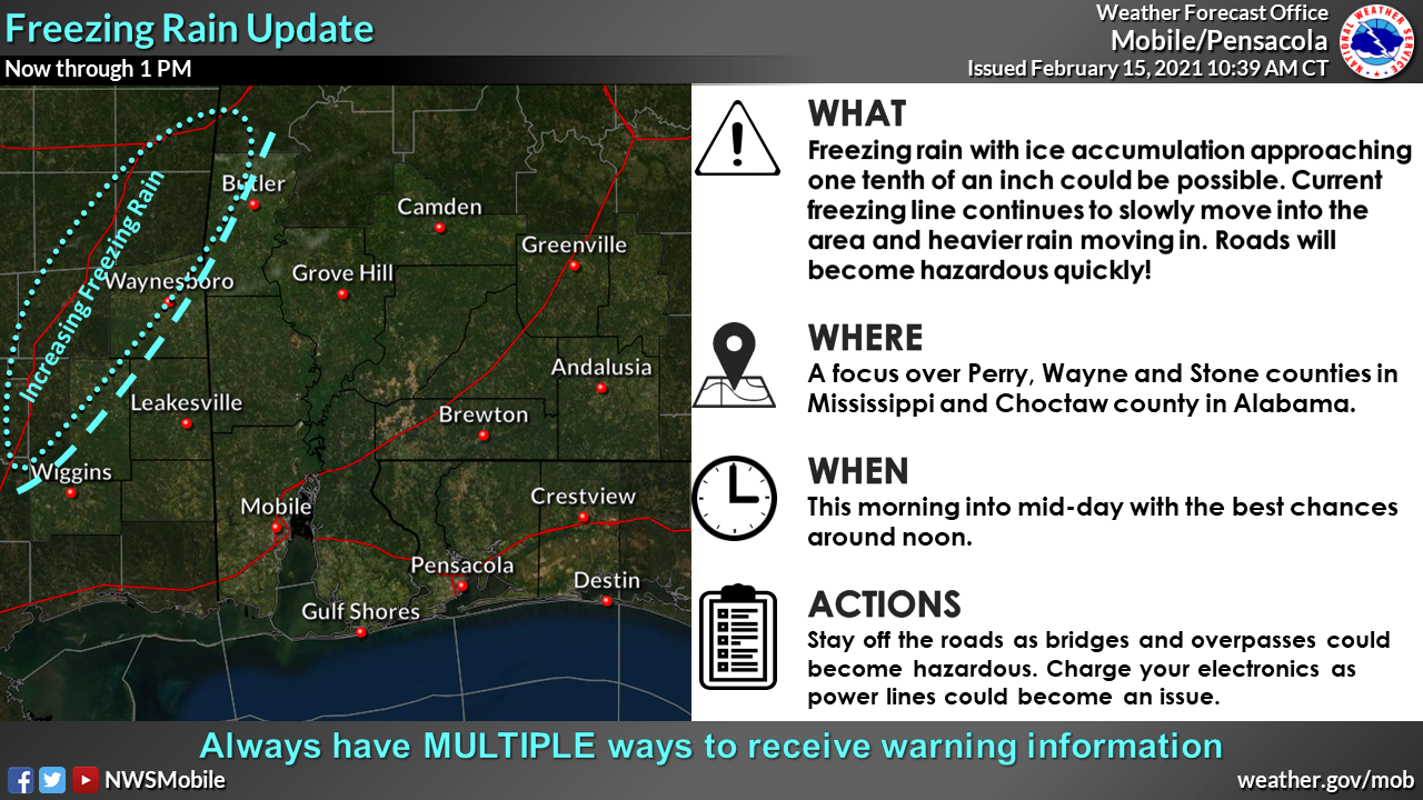
Overview: The freezing line has begun to move into Wayne, Perry, Stone counties in Mississippi and northwestern Choctaw county in Alabama. Increasing freezing rain is likely through about 1 PM. Freezing rain totals could approach one tenth of an inch and some isolated locations could approach two tenths of an inch. Once the rain stops, some freezing drizzle seems possible and the winter weather advisory may be extended into the overnight hours. Accretions during freezing drizzle will be minor.
Impacts: Roads will become hazardous quickly as temperatures drop into the 20s. Rain that has already fallen will freeze to elevated road surfaces along with the freezing rain on top of it. Accretion on trees could bring limbs down and impact power lines leading to some power outages.
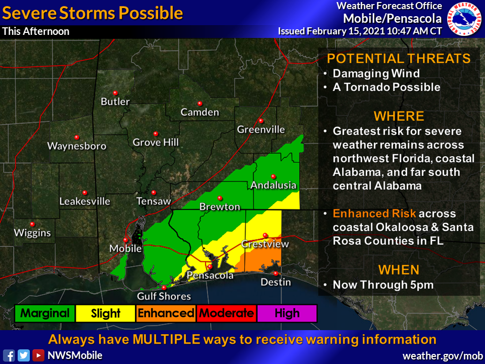
Severe Weather
Threat: Enhanced
Overview: Severe weather threat has increased as a line of supercells has developed over the open gulf waters. These storms will move inland over the northwest Florida Panhandle this afternoon beginning as early as noon and progressing through around 5 PM. This threat will be conditional on how far inland the instability will make it. Confidence is growing for at least some instability to move inland this afternoon.
Impacts:
Damaging winds- Damaging winds will be possible especially where instability along the coast is realized. Confidence is moderate to high.
Tornadoes– A tornado or two could be possible especially in southern Santa Rosa and Okaloosa counties. Confidence is Low.
Hail– Some hail could be possible, especially further inland. Confidence is Low to Moderate.
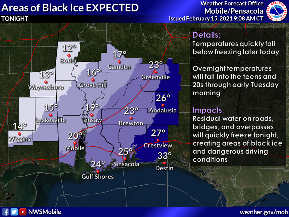
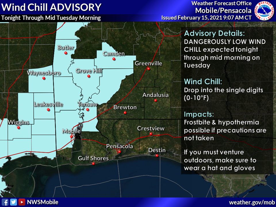
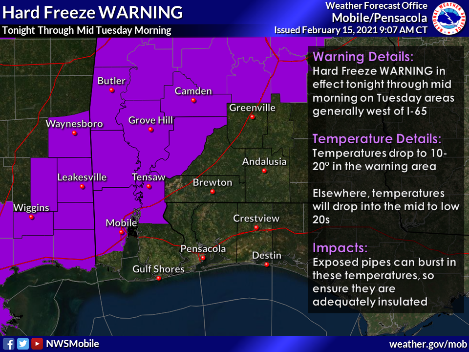
Freezing cold and black Ice
Overview: Temperatures will plummet tonight into the upper teens to low 20s across most of the area. Winds will remain elevated as well, leading to wind chills in the single digits to low teens. Given the widespread rain, any roads that are still wet will likely form black ice even as far southeast as coastal Florida.
Impacts: Long duration hard freeze conditions will persist along the I-65 corridor and west. Black ice will be likely on area roads across most of the area including coastal bridges and overpasses. Ice could persist into the early morning hours as it will take several hours to increase above freezing.