Cold front could bring showers, thunderstorms to area
Published 11:30 am Monday, October 21, 2019
|
Getting your Trinity Audio player ready...
|
A cold front approaching the area could bring thunderstorms and more rain this afternoon and evening.
After not receiving much rain for weeks, the area added several inches Saturday courtesy of a tropical development in the Gulf of Mexico.
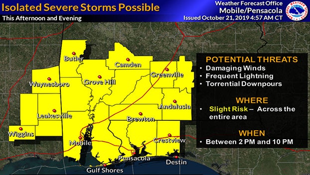
The National Weather Service in Mobile said that as the cold front moves through late this morning and early afternoon, a line of showers and thunderstorms are expected. A few of the storms could become strong or severe. The Storm Prediction Center had expanded the “slight risk” for severe thunderstorms across the entire area for potential of damaging wind gusts.
Overnight tornadoes in the Dallas, Texas, area caused heavy damage to homes and business structures. Tornado warnings sounded across the Mississippi Delta this morning, all caused by the front expected to be here this afternoon.
According to the National Weather Service, the time frame for possible severe weather in our area begins around 2 p.m. in the western parts of the region, moving eastward across the area through 10 p.m.
The storms are expected to leave the area late tonight and give way to cooler temperatures with overnight lows in the upper 40s.